-
Day 1
Arrival in Kathmandu airport (1345meters)
Our office reps will be on standby with our vehicle to receive you at Tribhuvan International airport, Kathmandu and our signboard will be displaying ABC & EBC Trekking outside the airport terminal. You will be then transferred to your respective hotel. This will be your first overnight in the ancient valley of temples (probably the most in the world) in the capital city of ancient Kathmandu (B/fast included)
-
Day 2
Orientation and Sightseeing around Kathmandu valley
Kathmandu is the traditional soul of Nepal and has been a well known destination for tourists ever since Nepal opened its borders to visitors. The city is a neat combination of Hinduism, Tibetan Buddhism and Western influence in the Valley. Patan and Bhaktapur, the two important neighboring cities bear much cultural and religious significance to Nepal’s landscape. There will be a half day guided tour to the famous and biggest Hindu shrine of Pashupatinath, the largest Buddhist stupa in Nepal Boudhanath, the 15th century Palace of 55 windows and Swoyambhunath. The rest of our time in Kathmandu is free for further exploration and some last-minute shopping in Thamel area near by your hotel. Your first Overnight at your hotel in the valley of cows that roam free, you probably won’t see this in any other city in the world. (Breakfast Included)
-
Day 3
Fly into Nepalgunj
Transfer to the airport for the flight to Nepalgunj, which lies close to the Indian border in the western Terai. This is one of the hottest cities in Nepal with soaring temperatures that pour out the sweat like water from a tap.
-
Day 4
Fly to Jumla [2370m] & trek to Gothi chaur [2700m]
We take a morning flight from Nepalgunj to Jumla. Leaving the airport at Jumla, we cross the Tila Khola and the Chaudabise Khola, near their confluence and climb gradually to a fertile valley of rice terraces. The trail passes through several villages. It continues through a forest of maple and walnut, to a meadow which, in season, is covered in wildflowers. Beyond the meadow, the trail climbs to a small pass before descending again to Gothi Chaur.
-
Day 5
Trek to Naphukana [3080m]
Today's walk follows the Tila Khola through fields of corn, potato, buckwheat and barley until the valley narrows and we enter a forest of oaks, spruce and maples. We pass through the village of Chotra with typical Tibetan mani walls. After a short distance, we come to another Tibetan-looking village, Naphukana. There is a large gompa above this village.
-
Day 6
Trek to Chaurikot [3060m]
From Naphukana the trail becomes steeper and climbs through a forest to a pass named Mauri Lagna [3820m]. From the pass there are views of snowy peaks to the north and east. Descending from the pass, the trail traverses a steep slope before dropping into a forest of pine and oaks. We then enter the Bheri Valley and after following the trail in and out of side valleys, we come to the village of Chaurikot.
-
Day 7
Trek to Bheri riverside [2610m]
Continuing on to the village of Balasa we can see Kagmara peak on the horizon. The trail drops to a stream before climbing through a forest of walnut trees to a ridge. Passing through the apple orchards of Jyakot, we then descend to the village of Rimi before following a rocky trail down to the Bheri River.
-
Day 8
Trek to Garpung khola [2900m]
We stay on the west bank of the Bheri River, passing Hurikot and arrive at the entrance to the Shey Phoksumdo National Park. We then come to the confluence of the Garpung and Jagdula Rivers, which joins the Bheri River. Following the Garpung Khola, we reach our camp by the riverside.
-
Day 9
Trek to Kagmara [3500m]
We continue to follow the Garpung Khola, ascending slowly towards the Kagmara La. Today is a short trek but it is very important for acclimatization that we don't ascend too quickly. It’s better for us to move at a relaxed pace.
-
Day 10
Trek to Kagmara Phedi [4000m]
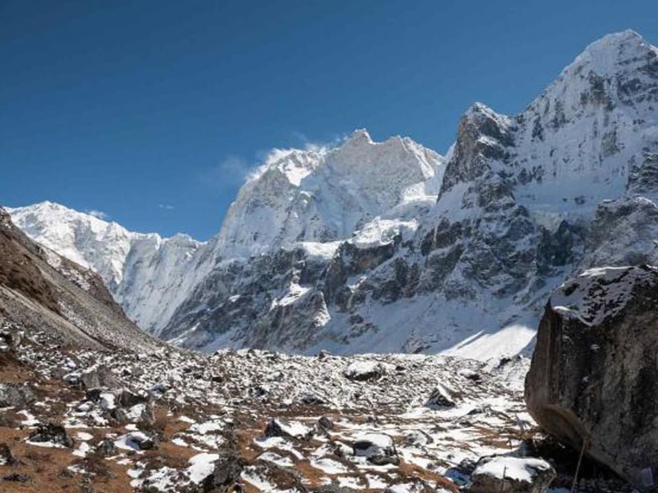
We now cross to the eastern side of the river, where the valley narrows and the river becomes a series of waterfalls. The trail climbs to a moraine below the Kagmara La and we make our camp among the boulders. We get magnificent views of the surrounding peaks from here.
-
Day 11
Cross Kagmara La [5115m]
We get an early start this morning and ascend alongside the Kagmara Glacier to the Kagmara La. This is a good place to spot the rare blue sheep. After a 900m descent, we reach the pastures of the Pungmo Khola Valley.
-
Day 12
Trek to Pungmo
The trail now enters birch and juniper forests which soon give way to blue pine. Up the side valleys, there are views of Kanjirolba peak before we reach the fortress-like village of Pungmo, set amidst barley fields.
-
Day 13
Trek to Phoksumdo Lake
We continue downstream to the national park headquarters at Sumduwa before joining the trail up the Phoksumdo Khola to Phoksumdo Lake. We climb through a forest of large cedars to the winter settlement of Palam and continue ascending through the open country to a ridge from which there are good views of the lake in the distance.
Close by is a fabulous waterfall, the highest waterfall in Nepal. The trail then makes an initial descent before climbing gently to Ringmo village. After crossing a bridge below Ringmo, the trail continues northwards to the shores of Phoksumdo Lake.
-
Day 14
At Phoksumdo Lake
Today is a rest day at the lake which is known for its unusual greenish-blue colouring. It is overlooked on the western side, by a large snowy peak known as Kanjirolba or Kanchen Ruwa. A trail leads through a stand of juniper trees to an old dilapidated gompa which overlooks the lake. We find Buddhist paintings and statues at this gompa; there is also evidence of the ancient Bon-Po religion within the temple and chapels.
-
Day 15
Trek to Baga La phedi
We retrace our route as far as Ringmo and then follow a trail eastwards, through forest of juniper and blue pine. The trail follows the river up the valley to a waterfall and we will reach at the base of the Baga La.
-
Day 16
Cross Baga La [5090m] & trek to Numa La phedi [4800m]
From our camp it's a steady 3 hour climb to the top of the Baga La, the second of the high passes. The descent is gradual at first but it soon drops steeply to a stream before ascending again to the foot of the Numa La.
-
Day 17
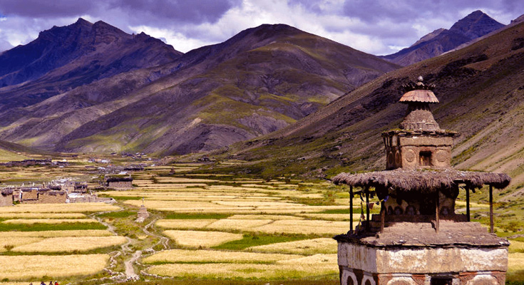
Cross Numa La [5360m] & trek to Do [4100m]
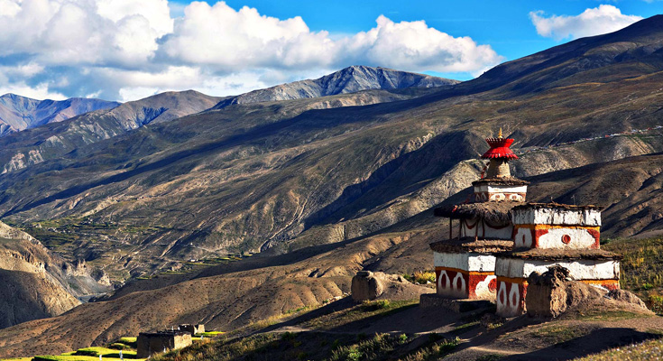
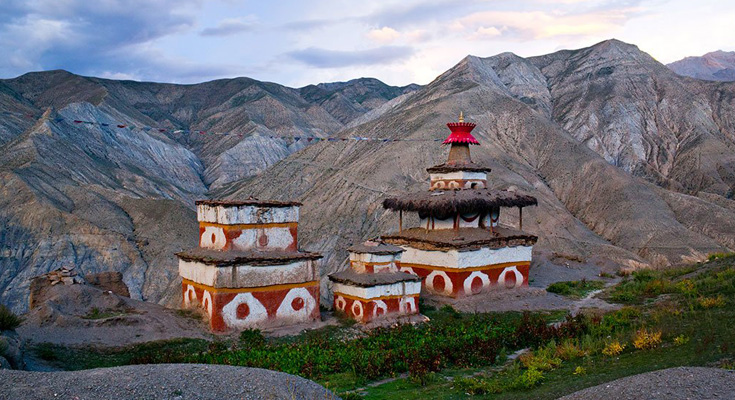
We continue climbing through arid country to the last of the high passes, the Numa La. It is marked by mani stones and, if it is a clear day, we can see as far as Dhaulagiri. The trail now descends past a huge mani wall to the Tarap region and we walk through the barley fields of the Tarap Valley to the settlement of Do.
-
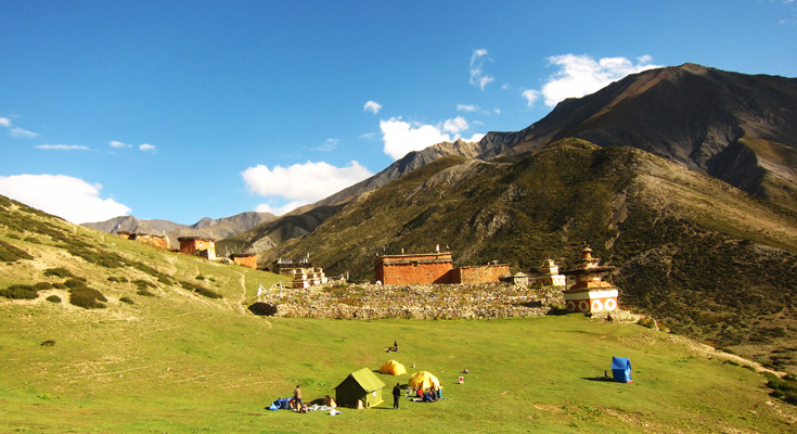
Day 18/19
At Do
These are rest days at Do. It is the largest settlement in Tarap and has several gompas. On the ridge above the village is the Ri Bhunpa Gompa and, just to the east, the village of Shipchhok has a Bon-po gompa which is certainly worth exploring. There are also opportunities to get great views of the valley and surrounding snow peaks from a number of nearby ridges.
-
Day 20
Trek to Lahini [3560m]
This morning's walk is almost level and follows the river until it flows into a gorge. We enter the gorge which has large rose shrubs and other wildflowers, and after crossing and re-crossing the river numerous times, we finally come to a flat expanse.
-
Day 21
Trek to Tarakot [2600m]
The trail today is steep, narrow and dangerous as it clings to the cliffs, and the bridges along here can often be washed out. Eventually, the valley widens and the route becomes easier as we approach the village of Khanigaon. We then climb high above the river before descending towards the Barbung Khola and the fortress village of Tarakot.
-
Day 22
Trek to Dunai [2100m]
We follow the Barbung Khola downstream along the south bank to the village of Lawan, before crossing to the north bank and walking for several more hours to Dunai.
-
Day 23
Trek to Juphal [2500m]
Today, we trek from Dunai to Juphal. From Dunai we follow the river trail downstream to Juphal. We walk uphill through meadows and past a few houses to the small hotels at Kala Gaura (2090m). After several hours of walking, we finally reach Juphal, which is the end point of our trek.
-
Day 24
Fly Juphal/Nepalgunj/Kathmandu
We take a flight from Juphal to Nepalgunj. We then take a connecting flight from Nepalgunj to Kathmandu.
-
Day 25
Kathmandu Departure for the special place called home
Today is free to relax and do your own things; perhaps some last minute shopping or pen a few post cards to the loved ones at home, until your departure or to commence any additional trips or activities you may have booked. If you are departing, you’ll be transferred to the international airport in time for your return flight home. Meeting you has been a wonderful experience that ABC & EBC Trekking will cherish for a long, long time; & on your way home, you’ll be thinking of a trip that will linger in your memories for a whole lifetime which we are sure will become fireside stories to be told to your loved ones on a cold winter night for the generations to come. Sayonara friends, till we meet again one day… Meals included: 1 breakfast.