-
Day 1
Arrival Kathmandu 1360m, overnight Kathmandu – Welcome dinner
You arrive in Katmandu and will be transferred to the warmth of your hotel. A pre-trek briefing will be scheduled to discuss the trekking program and co-ordinate any last-minute arrangements. Get familiar with your surroundings by going for a hike down the street before we head to a delicious dinner where the cuisine is prepared Nepalese style and is known for its healthy ingredients. This is your first overnight in the valley of the gods. Meals included: 1 welcome dinner.
-
Day 2
Kathmandu half day Sightseeing
Today we explore Katmandu on an organized sightseeing tour. This will include a visit to the Bodhnath Stupa, one of the biggest Buddhist shrines in the world. We also visit Pashupatinath, located on the banks of the holy Bagmati River and home to the most famous Hindu temple in the country. Here we will see Hindu holy men (sadhus) and pilgrims performing ritual bathing, and occasionally, funeral pyres burning on the Ghats. The cremation site here is open to all the citizens of Nepal that begins with royalty to the simple man on the street. The early afternoon will be free to relax in the hotel garden or visit Thamel for some last minute shopping. You will be provided with your trek departure information in the afternoon. Meals included: 1 breakfast.
-
Day 3
Kathmandu – Arughat (670m/2 200ft) – Soti Khola (710m/2 330ft), 135km, 8-9 hrs drive
Today we drive west from Kathmandu towards Pokhara through Middle Hill rural communities to Malekhu. Cross the Trisuli and head north to Dhading Besi. A slow, rutted dirt road then heads NW: over the Gola Bhanjyang with panoramic views of the Baudha and Ganesh Himals. Beyond this occasional views of Ganesh IV and VI will be seen above the valley walls as far as Khorlabesi. Shringi Himal appears from Salleri to Philim, from where Baudha Himal is also visible. Baudha and the Ganesh Himal are spectacular from Gumba Lungdang. Manaslu is not visible from the Tsum Valley and is first seen on the walk up to Lho from where Baudha Himal is also visible. Manaslu is first seen on the walk up to Lho. Drive on to Arughat and the Budhi Gandaki that drains the Manaslu–Tsum region. A further ~3 hrs drive up the west bank leads to Soti Khola. Overnight in Soti Khola with all meals inclusive
-
Day 4
Soti Khola – Machha Khola (890m/2 920ft), 6-7 hrs
Today we observe the Budhi Gandaki’s rising from the glaciers NW of the Larkya La; this is a runoff from tributaries, including the Siyar Khola from Tsum. A lot of water is added by the Tum Khola from the Tibetan highlands. The resulting outflow has cut more steeply into the rising ranges than in most other regions. Thus the lower trail must negotiate the steep sided main gorge, and numerous incoming tributaries: with exposed cliff-face trails and vertical-switchback paths. Today’s generally narrow trail undulates upwards through Sal forests and terraced ridges passing countless waterfalls. At times it clings to cliff faces or drops through rice paddies to the river gravels. Labubesi (880m) is an attractive Gurung village before the spectacular Nauli Falls and a long suspension bridge. Beyond, the valley broadens, the river flows more peacefully and the trail follows the bar to Machha (fish) Khola. Overnight in Machha Khola with all meals inclusive
-
Day 5
Machha Khola – Dobhan (1 000m/3 280ft), 6-7 hrs
After breakfast, we cross the Thado Khola, descend some stone stairs then follow the bar to Khorlabesi 970m, this is where coffee and tobacco crops are cultivated. The GHT trail through Gorkha (and Barpak, epicenter of the first quake on 25/04/15) crosses our trail, heading east from Manaslu to the Langtang then Everest regions. Enter a lush narrow gorge constricting the river’s progress. Cross a landslide with a dicey path, before the three hot spring spouts in Tatopani (930m). Climb a ridge then cross the Budhi Gandaki (to avoid a cliff face and waterfalls). A staircase then leads to a landslide before climbing to a ridge; and Dobhan. Overnight in Dobhan with all meals included
-
Day 6
Dobhan – Philim (1 590m/5 216ft), 6-7 hrs
After breakfast, we say good bye to Dobhan Khola, then follow the east bank to the village of Thulo Dhunga (1 840m); above cataracts. Later the gradient lessens, the valley opens and the water is placid at Yaruphant (1170m). we cross the Yaru Khola (from Ganesh II and VI) on an old suspension bridge then climb to the teahouses at Thado Bharyang. Cross back to the west bank and ascend gently to the old paved village of Jagat (1 410m): entrance and checkpoint to the Manaslu Conservation Area. Cross a tributary before a cliff-side trail to Salleri: with views of Shringi Himal (7 187m) to the north. Descend to Sirdibas; and the first symbols of Buddhist culture. A final bridge beyond Ghatta Khola (1 480m, water mills) to the east bank, leads to a steep climb up to Philim: a prosperous Gurung village set amongst millet and maize fields; see the Chholing Sandu Gompa. Overnight in Philim with all meals inclusive
-
Day 7
Philim – Lokpa (2 240m/7 350ft) – Chumling (2 390m/7 840ft), 6-7 hrs
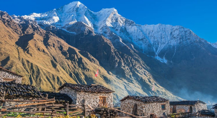
Today after breakfast, our trail meanders through scrub and lush grass up the wonderful narrowing valley to the high millet fields of Chisopani, then Ekle Bhatti (1600m, one house). Gradually descend, past a amazing waterfall, into the narrow lower gorge: and a junction, left to ‘New Bridge’ and the Larkya La. To the right a well-graded trail zigzags up through blue pines and rhododendron, to Lokpa in the narrow Lower Tsum Valley. Tsum has 18 villages and is home to 4000 people. Drop down through forest, before tackling a long, steep climb up the south wall of the Siyar Khola gorge; above the river draining Tsum. The ‘summit’ is landmarked by flags; overlooking colorful potato, bean and grain fields with Shringi Himal above. We descend to Gumlung and cross the river: for a final, gentler ascent to Chumling. The buildings are classic Tibetan but with sloping roofs to shed rain and snow. Overnight in Chumling with all meals inclusive
-
Day 8
Chumling – Chhokangparo – 3010m – 5-6 hrs reckoned
We hike across the suspension bridge onto the opposite bank. On the way we relish the great views of Ganesh Himal. We then walk past Rainjham to Serpu Khola. Now we enter the hidden valley of Tsum. Another steep climb takes us to the village of Chhokangparo. Weather permitting; we enjoy the great views of Himalchuli at 7893 meters. This is where we haul up for the night with all meals inclusive
-
Day 9
Chhokangparo – Nile – 3361m – approx – 6-7 hrs via Milarepa cave
Today it’s an interesting hike from Chhokangparo. We trek to Nile/Chulle. This is the last village heading north into the upper Tsum Valley. Nile is on the western, sun-side of the Shiar Khola, about 20 minutes hike across from Chhule. On the way we pass the Piren Phu cave. Piren Phu (means pigeon cave) is one of the most sacred caves in the Tsum valley. It is located at the foot of a rugged cliff near the village of Burji. Milarepa, the famous Tibetan saint, was believed to have meditated here. There are two separate gumbas attached to the rocky cave. Richly painted Buddhist murals, excellent artistic scripts carved on stones, long prayer flags and significant Buddhists paper scripts make this cave one of the most important socio-cultural possessions in this lovely valley. Gorgeous views can be had of the Shiar Khola, Rachen Gumba, the mountains and settlements amidst widespread agricultural land. This is an ideal place to set up camp for the night with all meals inclusive
-
Day 10
Exploration day: Nile – Mu Gompa (3 700m/12 140ft) – Chhekampar (3 030m/9 940ft), 6-7 hrs
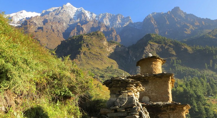
This is a lengthy day but it has its benefits. We head out early for the 2hr trek past snow crests to Mu Gompa (3 700m, 70 yrs). This is Tsum’s highest and last permanent settlement and overlooks the valley and western Ganesh Himal, including Ganesh I. Climb above Mu for a steep ¾ hr to the tiny Dephyu Doma Nunnery (4 000m, 856 yrs, place of the birth of light) perched on an unlikely slope: but with magical, exclusive views of Ganesh II and part of the western Himal. The trail continues N of Mu to high grazing kharkas (pastures) with goths (herder’s huts): a few with seasonal teahouse facilities on the two pass routes to Kyirong in Tibet. Return to Nile for lunch then retrace your steps to Phurbe and on to the extensive walled grounds of Rachen Nunnery (3 240m, 110 yrs, of the Ngak-pa-sect; that forbids all animal slaughter). Visit the intimate original monastery which stands in the SW corner of the complex, near the gate. Its old murals depict the history of Buddhism. Residential cells for the nuns and retreat buildings are set along and within the walls. A new, imposing light and airy temple with deities in tall glass-fronted cases now stands further back in the grounds. Cross the bridge below Rachen and walk back to Chhekampar for the night. All meals will be served inclusively
-
Day 11
Chhekampar – Gumba Lungdang (3 200m/10 500ft), 5-6 hrs
After breakfast, we return to the grouped chortens and descend into the Lower Tsum Valley and the gompa at Gho. Turn south, and cross the river to Dumje (Gumba Monastery owns a small school, herbal medicine clinic and fields here). A 3 ½ hr stiff climb through glorious oak, rhododendron and pine forest leads to a landmark mani wall and gompa views: then an exposed section before snaking up through giant silver pines to a ridge and the Nunnery. This is another dramatically placed site with tremendous all-round views. Gumba Lungdang (110 yrs) is currently home to 20 nuns. Expect a warm welcome and attend their evening puja. Morning views should offer one of the trek’s highlights. Overnight on the Gompa veranda with all meals inclusive
-
Day 12
Gumba Lungdang – Ripchet (2 470m/8 100ft) – Lokpa (2 240m/7 350ft), 7-8 hrs
After breakfast, we descend through forests to a small chorten and left fork onto a narrow trail to cross the Langdang Khola. Later climb steadily crossing two high bridges over impressive narrow gorges up to the village of Ripchet: an agricultural village cut from surrounding forest. After lunch, drop steeply down stairs to Gumlung at the river before re-tackling the forested pass and final ascent back to Lokpa. Overnight in Lokpa with all meals inclusive
-
Day 13
Lokpa – ‘New Bridge’ (1 670m/5 480ft) – Bihi Phedi (1 990m/6 530ft), 6-7 hrs
Today we hike down to the trail junction from Philim; drop to ‘New Bridge’ over the Budhi Gandaki (shortly before its confluence with Tsum’s Siyar Khola) and follow the trail as it curves NW into the Manaslu Valley. A broader trail gradually rises, through bamboo forest to Deng [1 800m, entry to Kutang/Lower Nupri (‘Nubri,’) - within Tibet until the 1840s]. The people are Gurungs who speak a unique dialect, practice Buddhism and still trade with Tibet. Cross to the East bank and climb to Rana (1 980m). We climb some steep ends at a log-bridge tributary-crossing before an isolated water mill. The trail then gently descends to Bihi Phedi; still high above the river. Overnight in Bihi Phedi with all meals inclusive
-
Day 14
Bihi Phedi to Namrung (2540m/8331ft): 6 hrs
After breakfast today, the first part of today's trek is on a relatively flat path. Soon, the trail moves uphill through the forest path. Thus we arrive at Namrung while enjoying at the same time the splendid views of Manaslu, among others. Overnight at Namrung with all meals inclusive
-
Day 15
Namrung - Lho – 3180m – 4 hrs
From Namrung, we again enter much Buddhism influenced region. We climb through the forest to Lihi. On the way, we enjoy the remarkable rise of the Ganesh Himal. We then descend to Sho. Another steep climb takes us to our campsite for the day on a high up ridge with all meals inclusive
-
Day 16
Lho - Sama Gaun – 3530m – 5-6 hrs at a trot
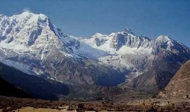
The raging Budi Gandaki is far down but we follow a small tributary instead. Walking through shady fir forest is a wonderful feeling. We soon reach a short climb to a plateau and the village of Shyala. Huge mountains surround us as we view Himal Chuli and Peak 29 (Ngadi Chuli) to the left, Manaslu and large glaciers straight ahead, other snow summits to the right, and by the far end of the valley we just came from stands towering Ganesh Himal. At the far end of the village, overlooking the valley stands the well known monastery of Sama. Sama Gaon is a village inhabited mainly by Tibetans and lies at the foot of Manaslu. It will be interesting spending the night here in out tented camps with all meals inclusive
-
Day 17
Sama: Rest and exploration day: Birendra Tal / Pungyen Gompa / Manaslu Base Camp
Sama is Nupri’s headquarters. Explore its architecture, customs and home industries. Items made for trade in Tibet include cloth for chubas and woven rugs using local or imported yarn from sheep and goats. Horses, Yak and Dzopkyo (yak-cow cross) herds are bred for trade.
Beyond and above the village is the 700 hundred year old Kargyu Chholing Monastery (or Labrang: Lama’s Place); its architecture is unique and has fine woodwork. The largest of its eight temple buildings is the Pemba Chholing Gompa, with an impressive statue of Guru Rinpoche. It is owned by the Nyingma Buddhist sect whose Lamas are permitted to marry and live within the complex. (Regrettably much of the Labrang was destroyed in a fire on 18 February 2015.)
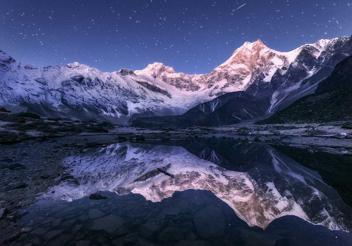
A short walk beyond the monastery leads to the Birendra Tal (3450m, lake) below the Manaslu Glacier. View it from a hilltop or drop to a stony beach which offers striking views of the terrain. 1½hrs, a demanding trail above the far side of the lake (reached from a path at the bridge over the outflow stream) climbs 1200m past the glacier’s snout to the Manaslu Base Camp (4 900m), 5-6 hrs
A trek to the Pungyen Nunnery (3 870m), on a ridge above the Pungyen Glacier; offers superb views of the Nadi ice-ridges and Manaslu towering over the gompa. To reach the gompa, return towards Shyala, passed the school to the turnoff. The trail heads over a ridge above the Numa Khola and drops onto the Pungyen Glacier. Walk to the ridge on which the gompa is built. ~2½hr. The route can be very cold and slippery; we stop here for some refreshments.
In 1953, much of the gompa was destroyed in an avalanche – and was only recently rebuilt. Blame for the avalanche was apportioned to the first Japanese (unsuccessful) expedition to Manaslu. They were the first to conquer it – in 1956. We return to Sama for the night with all meals served inclusively
-
Day 18
Sama Gaun – Samdo – 3860m – 4-5 hrs
After breakfast, we descend to the Budi Gandaki, which sees us turning north, and follow it to a bridge over a side stream. The trail to the left leads to the Manaslu Base camp. The Larkya la Trail passes several mani walls as the valley begins to widen. It is an easy trail on a shelf above the river passing juniper and birch forests of Kermo Kharka. We drop off the shelf, cross the Budhi Gandaki on a wooden bridge and climb steeply onto a peninsula between two forks of the river. From a stone arch we can see a large white kani, finally passing through the kani we find Samdo. Overnight in Samdo with all meals inclusive
-
Day 19
Samdo – Larkya Phedi/Dharamsala (4480m/14 700ft), 3-5 hrs
After breakfast today, we drop for the final crossing of the Budhi Gandaki below the former Larkya Bazaar site (3 650m, a popular seasonal trading post before the border was closed). The diminished stream flows from the northern Pana Danda Valley: where a trail leads to two passes to Tibet. Our trail heads west and climbs gently through low scrub above the Syacha Khola and glacier. Its descent from Manaslu North can be seen up that valley.
The trail steadily ascends towards the Larkya Glacier’s snout beyond the hidden Larkya Phedi which gradually comes into view. This seasonal kharka had a kitchen with dining room, 15 small double rooms in two rows (one collapsed in the recent earthquake) and two tunnel tents; each with eight beds plus a third for trekking staff. Better views of the Naike (6291m) and Larke (6249m) peaks can be had from higher up the side of the valley. Rest and overnight in Dharamsala with all meals inclusive
-
Day 20
Dharamsala – Larkya La (5160m/16930ft) – Bimthang (3720m/12 200ft), 7-9 hrs
Larkya La involves an 800m, 3-5 hr ascent (when snow free) and a 1500m, 3-4 hr descent to Bimthang. It can be bitterly cold if windy; snow and ice will demand more time. Snow poles mark the route along the moraine: it is not difficult or steep, but is long and everywhere rocky underfoot.
A pre-sunrise start begins with a gentle ascent to a ridge before a long ascent to the vast, jumbled moraine field. Ahead Pawar Peak on the northern border wall of Cheo Himal and Larke Peak on the southern Larkya Himal gradually appear above the moraine. Walk past the first of four small scattered lakes. Finally a steady pull curves towards Larke and the first group of summit flags.
The reverse view overlooks the trail, distant Sonam Peak and ranges into Tibet. The Cheo and Larkya Himal ridges block views to the north and south.
Ahead, a moraine ridge, separated from the Larke wall by a parallel gully leads, for 30 min, to a second set of landmark flags: and the boundary between the Manaslu and Annapurna conservation regions. They also overlook astounding views into a huge semi-circular basin ringed by a mix of magnificent ice peaks and eroding grey rocky walls. Within, three glaciers flow towards the southwest corner. From the pass, there are outstanding views of Himlung Himal, Cheo Himal, Kangguru and the huge Annapurna II. We relish the amazing views from the top of the pass. It is a longer day than expected to Bimtang, but to walk into these low pastures with the evening fog setting in and nearby Manaslu; it's an experience we don’t want to avoid. Bimthang has become the summer grazing settlement for the Samdo population. It was an important trading post before the closure of the Tibetan border. Tibetan Khampa warriors had a centre here in the 1970s. Overnight in Bimthang with all meals inclusive
-
Day 21
Bimthang – Gho (2 560m/8 400ft), 5-6 hrs
After breakfast, we walk across the Bimthang Plain; then begin a 1200m descent to Gho. Cross the stony glacier before climbing its far moraine to enter magnificent pristine oak, rhododendron and pine forests. Views of the Manaslu – Chuli Range continue along the route. Descend along the Dudh Khola’s west bank to Hompuk (3 430m, a rock shelter near a bridge) then attractive Sangura Kharka (3 430m). Drop steeply to cross the Suti Khola to Karche (2 700m) for lunch. Follow the river’s S bend then negotiate a flood related landslide and a steep ridge climb past terraced fields to the appealing Gurung village of Gho. Overnight in Gho with all meals inclusive
-
Day 22
Gho – Tal (1 700m/5 580ft) 6-7 hrs
After breakfast, descend through farmlands to the old paved village of Tilje (2300m). Cross to the river’s east bank and descend rapidly into the Marsyangdi Valley through scrub forest. Return to the west bank before Thonje (1 965m) and then, in Thonje, cross the descending Marsyangdi Khola from Manang prior to their confluence. We then join the new road from Manang on the Annapurna Circuit and descend to vibrant Dharapani for lunch. After lunch follow the road down to Khotro (1860m) then cross to the river’s eastern bank to trek down the steep trail to the attractive and quieter village of Tal. Here the river is placid, flowing between wire mesh gabions. Overnight in Tal with all meals inclusive
-
Day 23
Tal – Besi Sahar (760m/2 500ft) – Kathmandu (1 300m/4 260ft), 190km, 7-8hrs
After an early breakfast, take a jeep for the rutted descent (passing the development of an impressive new hydroelectric scheme) to Besi Sahar. Then, travel east on the paved road back to Kathmandu. For an option, we can drive west to explore the Lake City of Pokhara (106km), south of the Annapurnas. Return to Kathmandu by plane or tourist bus. Whichever way, overnight at your hotel for some luxury and a warm soft bed with breakfast and lunch
-
Day 24
Drive to the Airport to head back to that lovely place we call ‘home’’
After b/fast, our rep and office vehicle will be on standby at our hotel to transfer us to the airport for our connecting flight home. Serving you was a wonderful joy and pleasure, we at ABC and EBC Treks will cherish the bonds of our relationship created over the time you spent with us and we thank you for choosing us as your travel partner and for visiting this amazing country Nepal. We are sure that trekking in this beautiful region of the Annapurnas will give you lifetime memories of a vacation well enjoyed. Ciao friends! Till we meet again. Breakfast